
There are two distinct types of map that can be loaded into Garmin GPS devices – raster maps and vector maps.
Raster maps (such as the Ordnance Survey’s Landranger series) are essentially scans of printed maps which are used as overlays. Their accuracy is fixed – magnification reveals no additional details and pixellation of the image rapidly becomes apparent. Furthermore, individual objects cannot be labelled or identified electronically (eg one cannot use a search function to highlight features such as trig points, roads, houses etc). Generally speaking, GPS users obtain their raster maps by scanning paper versions, using aerial photographs, or taking computer screenshots.
Vector maps (such as Garmin’s proprietary City Navigator Europe product) contain a collection of objects each defined by a number of simple elements. Each object can be individually identified (ie given a name) and is infinitely scalable. Just as important, the maps can be relieved of clutter by arranging elements in such a way that the greater the magnification, the greater the number of objects displayed. Generally speaking, vector maps are difficult for an amateur to create and upload to GPS devices.
For more details concerning raster and vector maps, take a look at the Ordnance Survey’s video on the subject.
Official Raster Maps
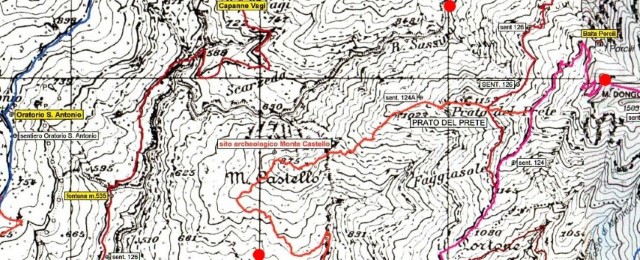
The province of Massa Carrara publishes official raster maps derived from the 1:10000 scale Regione Toscana master series. These are available in PDF format and may be downloaded here. The maps have the following characteristics:
- Main emphasis is on delineating roads.
- Footpaths and tracks are shown but are not numbered or otherwise identified.
- Generally printed black on white.
- Detailed contours.
- Copyright free for private use.
(Free) Vector Maps
If you want up-to-date vector maps specifically configured for users of the Garmin BaseCamp (Mac, Win) application and owners of Garmin devices then the Freizeitkarte project should be your first port of call.
The Freizeitkarte maps are based on OpenStreetMap data and are in the .img format. Instructions for use are simple and may be found on their web site.
One of the many useful features of the maps is that they can readily be modified to suit the display characteristics of individual GPS units. How to do this is explained on the web site, but in essence one takes the standard map and then applies an instruction file (extension .TYP) to impose the desired modifications using the (free) JaVaWa GMTK software package.
JaVaWa GMTK is a very useful utility that can also be used to fix a range of problems encountered with Garmin GPS and SatNav devices. For example, from time to time SatNav lifetime map updates go wrong, with BaseCamp locking the map and requesting an unlock code. JaVaWa can copy the required code from a SatNav to BaseCamp, thus making the map in question available on a PC without the SatNav being connected. (In this regard it’s necessary to make the SatNav visible to JaVaWA by switching it from the standard Media Transfer Protocol (MTP) to Mass Storage Mode (MSM)).
Custom Raster Maps
First, a note about copyright.
In the UK, royalty free copying of copyrighted material is allowed only under certain conditions. These are laid down in the Copyright, Designs & Patents Act 1988, and a summary may be viewed here. In essence, copies may be taken for the following purposes:
- Research and study
- Criticism or review
- Reporting of current events
- Parody, caricature and pastiche
- Quotation
In Italy the situation is quite different (details here). Most importantly there is no concept of fair use or fair dealing so that any reproduction of any part of a copyrighted work is likely to be a contravention of the Civil Code. That said, many Italian web sites use small sections of the IGM maps to record routes taken by walkers, mountain bikers and climbers, and the IGM appears to be relaxed about the practice.
We have always tried to play fair with regard to copyright and we recommend you do the same. We always purchase paper maps from the copyright owners before digitising sections to load into our GPS units (ie we don’t copy maps from other web sites unless they are out of copyright and we don’t buy maps second hand) and we never scan, copy or digitise complete works.
To avoid copyright issues altogether one can make use of OpenStreetMap – either directly or via sites which are based on the OpenStreetMap data such as Organic Maps.
Sample custom maps for Garmin GPS devices
Listed below are a few custom map samples that have been tiled so that they can be uploaded to a compatible Garmin GPS via Garmin’s BaseCamp software or directly via the Windows File Explorer.
We strongly recommend that any custom maps are placed on an SD card and not into the GPS’s internal memory. Indeed, we’d further advise that the SD card be loaded whilst it’s in a laptop or desktop machine and only then placed in a GPS. Neglect this advice and sooner or later your GPS firmware will be corrupted and you’ll be left with an expensive doorstop!
Examples for you to download: